Smoke, Evacuations, and Rising Insurance Costs: What Utah's Wildfire Season Means for Homeowners and Buyers
Does an active Utah wildfire affect your homeowners insurance or home value? It can. With Utah's new HB 48 wildfire risk maps in effect, 60,000+ structures now carry a formal high-risk designation that directly affects insurance availability, annual premiums, and long-term equity, whether you already own or are planning to buy.
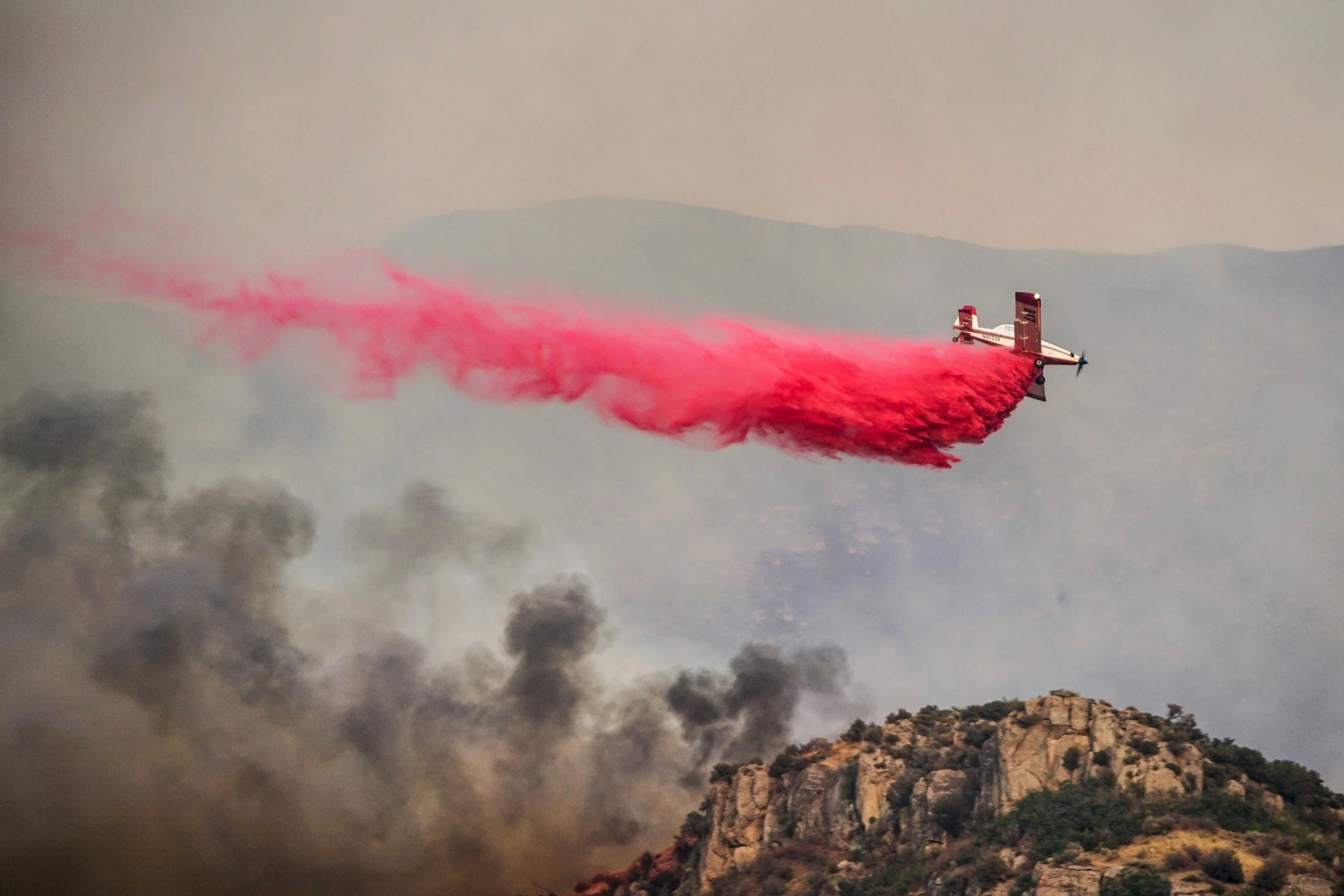
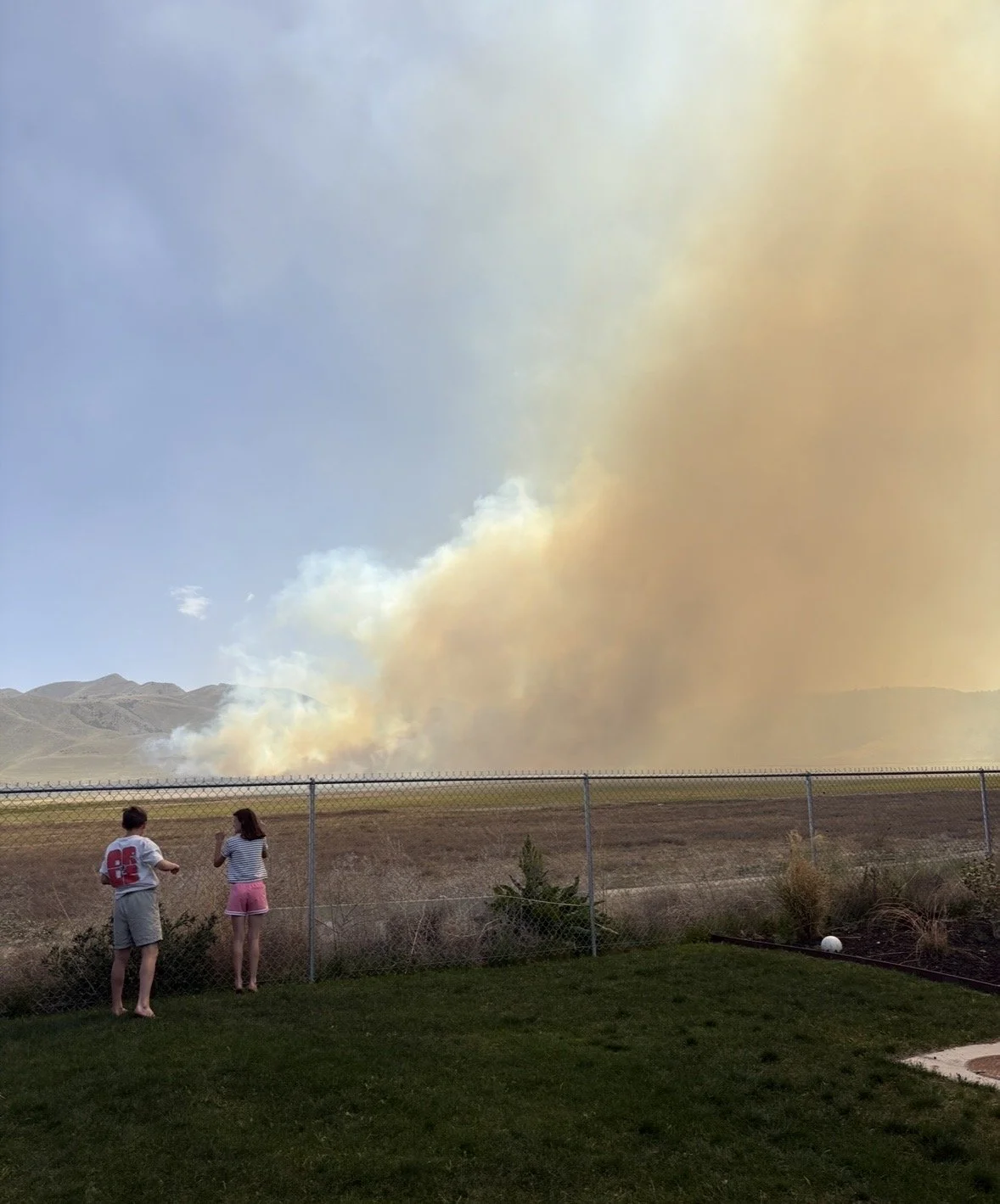
As of June 24, 2026, there are six active wildfires burning across Utah, and the smoke from several of them has been settling into the Salt Lake Valley all week. The Bonneville Fire erupted June 20 in the east bench foothills above the University of Utah, burning 566 acres before reaching 84% containment. The Iron Fire near Eureka has grown to over 37,000 acres with Eureka still evacuated. The Cottonwood Fire near Beaver in Millard County has exploded past 24,000 acres with zero containment and mandatory evacuations in multiple communities. The Hastings Fire in Tooele County, already at 20,000 acres, is responsible for most of the smoke blanketing the Salt Lake Valley. And the Dutchman Fire started Monday on Lake Mountain in Utah County, south of Saratoga Springs, just miles from the southwest valley.
If you own a home anywhere in the Salt Lake Valley, or you're trying to decide where to buy, these fires raise questions worth having answers to now.
What's Happening With Utah's Wildfires Right Now
Are you wondering why the whole state of Utah feels like it is on fire right now? We all know that Utah is in a drought, and that is making the land ready to burn as soon as a fire starts. Utah fire officials said it plainly this week: "We knew this was coming." The state just recorded one of its driest winters on record, leaving vegetation across the Wasatch Front and central Utah parched heading into summer. Six larger wildfires are now burning simultaneously, and the Great Basin region, which includes Utah, is currently one of the most active wildfire areas in the country.
Here's where things stand as of the morning of June 24:
The Iron Fire started Friday night near Eureka, human-caused and fast-moving. It has grown to over 37,000 acres and Eureka residents remain under mandatory evacuation. Firefighters have conducted firing operations to slow its spread toward power infrastructure on the east side of the fire.
The Cottonwood Fire near Beaver in Millard County ignited Monday evening and exploded to more than 24,000 acres with 0% containment. Mandatory evacuations are in place for Eagle Point, Merchant Valley, HiLo Estates, and Arrowhead Summer Homes. State Route 153 is closed in both directions.
The Hastings Fire in Tooele County is burning approximately 20,000 acres at 25% containment. Also human-caused, it's the primary source of the heavy smoke that has blanketed the Salt Lake Valley this week and pushed air quality into unhealthy ranges.
The Bonneville Fire in Salt Lake City's east bench foothills burned 566 acres above the University of Utah campus. It is now 84% contained. Evacuation notices for the Arlington Hills neighborhood have been lifted, though crews remain on scene.
The Dutchman Fire started Monday on Lake Mountain in Utah County, south of Saratoga Springs, putting it just miles from the southwest valley communities. It burned 143 acres and is now largely contained, with no structures threatened and no evacuation orders issued.
The Sawmill Fire in Iron County in southwest Utah started June 16 and has burned roughly 4,000 acres at 20% containment.
These aren't isolated events. Utah's fire seasons have intensified, and the state has responded with legislation that directly affects homeowners.
Utah's New Wildfire Law and What It Costs Homeowners
In 2025, Utah passed HB 48, which created a formal wildfire risk mapping system administered by the Utah Division of Forestry, Fire and State Lands. The maps went into effect at the start of 2026. Here's what the law actually does:
It identifies high-risk structures. Right now, approximately 60,000 structures across Utah have been classified as high-risk based on their location in or near wildland-urban interface (WUI) zones, the places where developed neighborhoods meet undeveloped wildland. These are primarily foothill and canyon-adjacent neighborhoods.
It charges a fee. Properties classified as high-risk are assessed an annual fee ranging from $20 to $100 per structure based on square footage. Homeowners who proactively reduce their wildfire risk may qualify for a reduced fee. Starting in 2028, any property that has not completed a lot-level wildfire risk assessment automatically moves to the highest risk tier.
It triggers insurance scrutiny. Utah law now requires insurers to provide written justification if they raise rates by 20% or more, or cancel a policy due to wildfire risk. That protection exists because the problem is real: carriers have already begun dropping policies in high-risk areas, and homeowners across the east bench and foothill neighborhoods are seeing premiums climb significantly. Fox 13 reported on the insurance concerns sparked directly by these new maps.
This isn't hypothetical anymore. It's a line item that didn't exist a year ago and it will only become more relevant as fire seasons intensify.
Questions Homeowners Ask When a Fire Burns Close to Home
When a fire breaks out nearby, the questions come fast. Here are the ones we hear most, and what you actually need to know.
Will my insurance rates go up because of a nearby fire? Not automatically, and not immediately. A fire in your region doesn't trigger an automatic rate increase on your specific policy. What it does do is prompt insurers to reassess risk maps for the area. If your neighborhood is reclassified as higher risk at your next renewal, you could see a rate change then. Under Utah's current law, insurers must provide written justification for any rate increase of 20% or more tied to wildfire risk, so you have the right to ask why if your renewal comes in significantly higher.
Am I covered if a wildfire damages my home, even if there's no direct flame contact? Most standard homeowners policies cover fire damage, including structure loss from wildfire. Smoke and ash damage is also typically covered. What's murkier is business interruption or additional living expenses if you have to evacuate. Read your policy's "loss of use" section now, before you need it, to understand how long your carrier will cover temporary housing and what the daily cap is. If you're not sure, call your agent and ask directly.
What if I'm told to evacuate? What should I document before I leave? If you get a READY or evacuation order, do a quick walkthrough with your phone before you go. Video every room, open closets and cabinets, capture serial numbers on appliances and electronics. Upload it to cloud storage before you leave the property. This documentation matters if you file a claim and the situation deteriorates while you're out.
Should I call my insurance company now, even if nothing has happened to my home? It's not a bad idea to review your policy and confirm your coverage limits are current. A lot of homeowners are underinsured because their coverage hasn't kept pace with construction costs since 2020. If your dwelling coverage was set five years ago, the cost to rebuild your home today may significantly exceed that number. A quick call to your agent to review your replacement cost coverage is worth 20 minutes.
What if my insurer drops me or won't renew because of wildfire risk? This is happening to homeowners in high-risk zones, primarily foothill and WUI-adjacent neighborhoods. Under HB 48, carriers must provide factual justification if they cancel or non-renew due to wildfire risk. If that happens, your next step is the Utah Insurance Department, which maintains resources for homeowners who've lost coverage. The Utah FAIR Plan is also an option of last resort for properties that can't obtain coverage in the standard market.
How Wildfire Risk Affects Home Value Over Time
First, if you’re trying to sell, a close fire can cause buyers to pause.
Beyond that, insurance is the most immediate cost. But the longer-term dynamic is what smart buyers are starting to pay attention to.
When insurance becomes difficult to obtain or prohibitively expensive in a neighborhood, demand softens. When fees pile on top of already-high carrying costs, the affordability math changes. When an active fire gets within a mile of a neighborhood and evacuation notices go out, some percentage of residents start reconsidering whether they want to be there.
None of this is unique to Utah. Research from the National Bureau of Economic Research has documented measurable home value discounts in wildfire-risk zones, particularly in markets where high-profile fire events have occurred. Buyers in California, Colorado, and Oregon have been navigating this for years. Utah is catching up fast.
The foothill neighborhoods of east Salt Lake City, east Murray, parts of Draper bordering the Wasatch, and areas near the canyons offer genuine lifestyle appeal. But that appeal now comes with a financial cost structure that flat-valley neighborhoods simply don't carry.
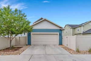
Where Daybreak and South Jordan Fall on the Risk Map
Daybreak in South Jordan (ZIP 84009) sits on the valley floor, well west of the Wasatch foothills. There's no canyon interface, no ridge-line exposure, and no wildland-urban boundary running through the neighborhood.
Under Utah's new HB 48 risk mapping, properties in the Daybreak community are not among the 60,000 flagged high-risk structures. Homeowners here aren't facing the new wildfire fees or the insurance disruptions hitting properties closer to the foothills.
The Dutchman Fire this week is actually a useful illustration of this. It started on Lake Mountain, south of Saratoga Springs, a few miles west of Daybreak. The fire stayed in remote, undeveloped terrain on the mountain and was contained without threatening any homes. That's different from the dynamic in foothill neighborhoods where the wildland-urban interface runs directly along the edge of developed subdivisions. Geography matters.
That's not the main reason to buy in Daybreak. The main reasons are still the lakes, the trail network, the TRAX Red Line, the Downtown Daybreak buildout coming online this summer, and a master-planned community design that has stayed consistently competitive in the Salt Lake County market.
But the wildfire calculus is a legitimate factor for buyers comparing Daybreak to east-bench and foothill neighborhoods, and it's one that doesn't always come up in the initial conversation.

What to Ask Before You Buy Anywhere in the Salt Lake Valley
If you're evaluating homes in the greater Salt Lake area, a few wildfire-related questions are worth adding to your due diligence list before you go under contract.
Is this property in a designated high-risk wildfire zone under Utah's HB 48 maps? Your agent should be able to check, or you can search the Utah Division of Forestry, Fire and State Lands wildfire risk viewer directly.
What is the current homeowners insurance situation for this property? Ask the seller for their current insurer and premium. A property that has already been dropped once or switched carriers recently is a signal worth investigating before you take ownership.
Has this neighborhood ever been under an evacuation notice or order? Not a dealbreaker on its own, but relevant context for your risk tolerance and for conversations with your insurer during the option period.
What does the annual wildfire mitigation fee look like for this specific parcel? That amount varies by structure size and risk tier. It needs to factor into your real carrying cost calculation alongside your mortgage, taxes, HOA, and insurance.
For current homeowners: these same questions apply when you're reassessing your own situation. Knowing exactly where your property falls on the HB 48 risk map, and what your current coverage actually includes, is baseline knowledge worth having in a season like this one.
FAQ
Does wildfire risk affect home values in Utah? Yes. Properties in high-risk wildfire zones face a combination of rising insurance premiums, potential policy cancellations, and new annual fees under Utah's HB 48 legislation that took effect in 2026. Over time, the added cost of ownership in high-risk areas can soften buyer demand and affect resale value compared to properties in lower-risk locations.
Is Daybreak, South Jordan in a wildfire risk zone? No. Daybreak (ZIP 84009) sits on the valley floor well away from Utah's wildland-urban interface zones. The community is not among the 60,000+ structures flagged under Utah's HB 48 wildfire risk maps, which means homeowners here are not subject to the new annual wildfire mitigation fees currently affecting foothill and canyon-adjacent neighborhoods.
What is HB 48 and how does it affect Utah homeowners? HB 48 is a Utah law passed in 2025 that created a formal wildfire risk mapping system administered by the state. Effective 2026, approximately 60,000 structures across Utah classified as high-risk now pay annual fees of $20 to $100 per structure. Properties that don't complete a wildfire risk assessment by 2028 automatically receive the highest risk classification. The law also requires insurers to justify any rate increase of 20% or more tied to wildfire risk.
Does homeowners insurance cover wildfire damage in Utah? Standard homeowners insurance policies in Utah generally cover direct fire damage to your structure and personal property. Smoke and ash damage is typically included. Loss-of-use coverage for temporary living expenses during an evacuation varies by policy. Review your coverage limits now, particularly your dwelling replacement cost, to make sure it reflects current construction costs rather than what you set years ago.